Saille tour
From the moment you reach the summit via the Jorasse chairlift, a dirt track guides you effortlessly to the Bougnonne stables. This mountain pasture, owned by Leytron, was managed independently until 1963. Today, it is the second most important alpine pasture after Odonne. The gently sloping route takes you to the banks of the Salentse, an inescapable river which, by turns discreet and impetuous, shapes the life of Leytron and Ovronnaz.
The old stables of Saille can be seen below, then the path continues to climb towards the Rambert hut, as far as the Pierre à Vatserou. Sitting on this imposing stone, the chief shepherd once kept watch over his flock.
Leaving this path, you take a magnificent path along the hillside, winding between rocky bars and scree at the foot of the Pointe d'Aufalle ridge. Larches, alders, bilberries and wooded pastures then guide you towards Larzay and Chavanne Neuve, where an old coach house once stood on the Bougnonne mountain pasture. Your tour ends at the top of the Jorasse chairlift.
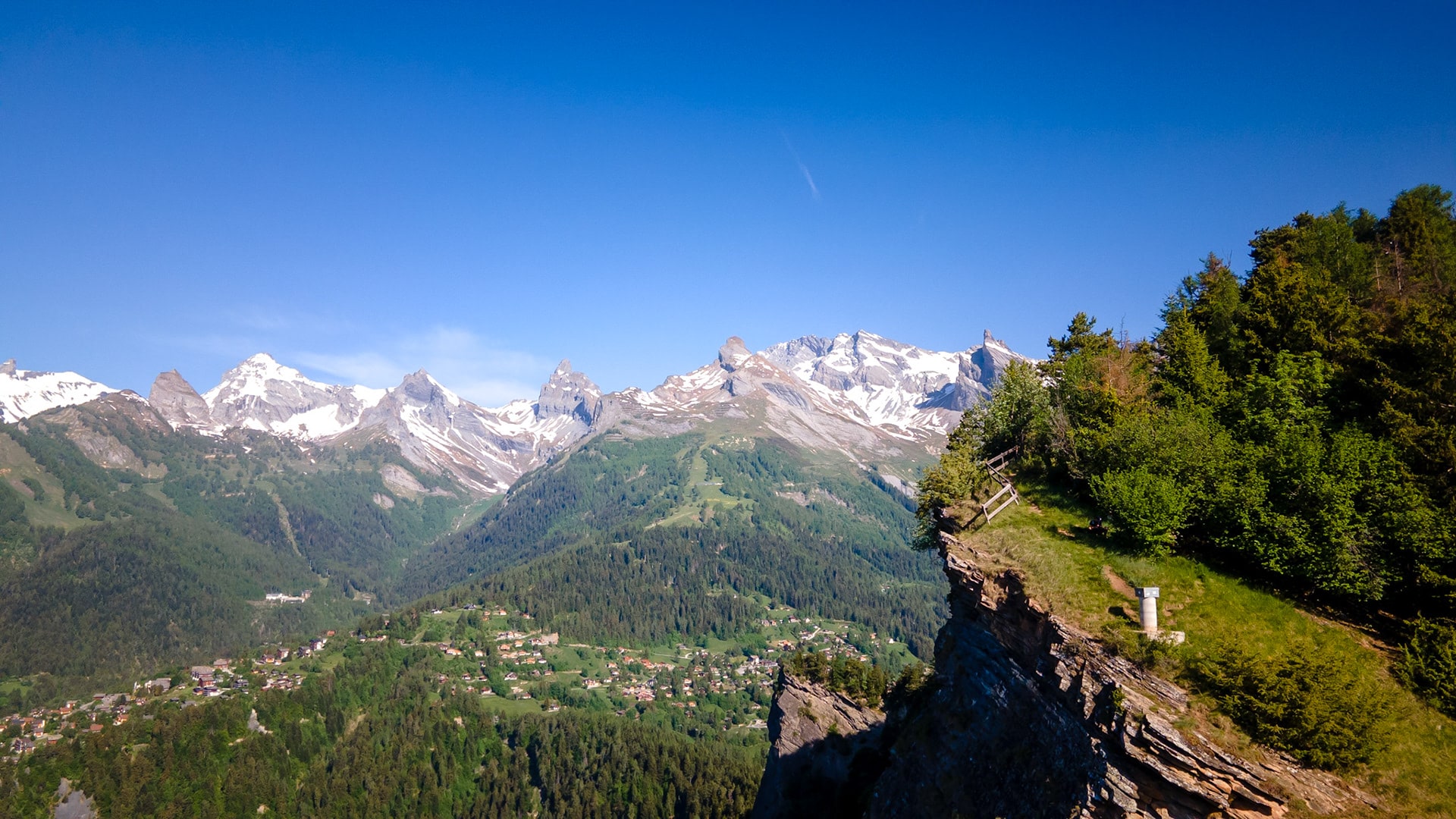
Explore the Creuse path, a veritable balcony offering magnificent views over the Ardève. The route then takes you up this hill, which looks like a mountain. Although steep at times, the path rises through a forest of conifers. Halfway up, a handrail makes it easier to cross a rocky bar. Follow the ridge to the summit for a magnificent panoramic view of the Rhône valley. Return via Les Mayens de Chamoson. Head back down the forest road that winds along the wooded slopes of the mountain towards Les Mayens de l'Ardève. Then cross the Mayens de Chamoson to rejoin the Creuse path that leads to Ovronnaz .
If you prefer an easier, less steep alternative : Take the route via Les Mayens de Chamoson only, which avoids the crossing with the handrail.
Features
Length
10.7 km
Difficulty
Medium / T2 (short section T3*)
*Mountain route with a short section of iron handrails to ensure your safety.
Duration
3h30 (no break)
Height difference
+612 m / -612 m
Minimum altitude
1066 m
Maximum altitude
1487 m
Starting point
Ovronnaz Tourist Office
Point of arrival
Ovronnaz Tourist Office
Period
May to October depending on snow conditions
Did you know ?
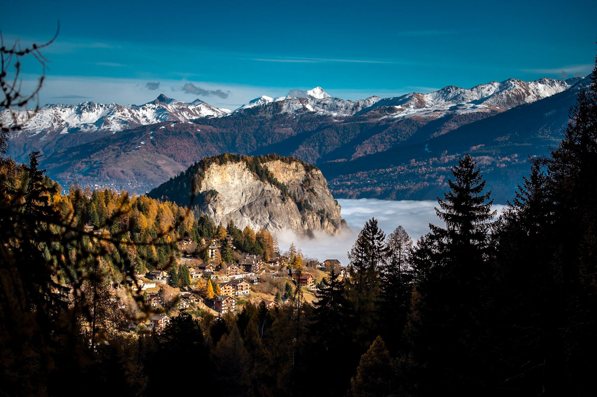
The rock face of the Ardève overlooks the Rhône plain from an impressive height of almost 800 metres.
For fans of the Earth sciences, the Ardève offers an exceptional opportunity to decipher the geological evolution of the Alps. Its geological history can be explored through three distinct aspects: the formation of rocks, their deformation and their erosion over time.
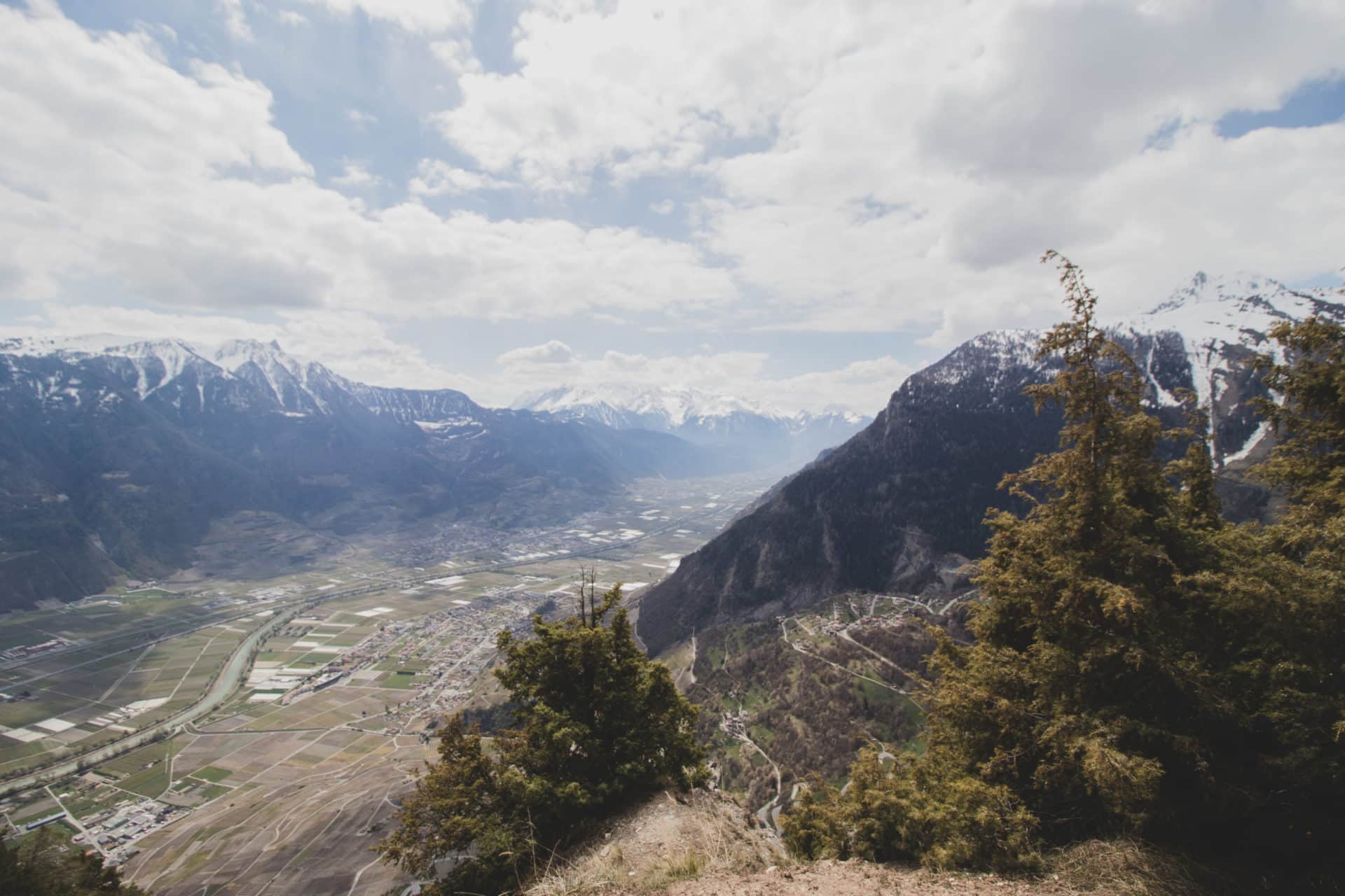
The southern end of the Ardève is a veritable perched observatory, offering an incomparable panorama stretching from Martigny to Leuk.
While the southern and south-western flanks are arid, the northern and north-eastern slopes of this imposing mountain are covered in forest vegetation.